Monitor hurricanes, typhoons, and tropical cyclones in real time.
Zoom Earth is a live interactive weather map and real-time hurricane tracker. Key features include satellite imagery, rain radar, weather forecasts, hurricane tracking, wildfire monitoring, and extensive customization settings.
[Key Features]
1. Satellite Imagery: View near real-time weather maps with satellite images sourced from NOAA GOES, JMA Himawari, EUMETSAT Meteosat, and NASA's polar-orbiting Aqua and Terra satellites.
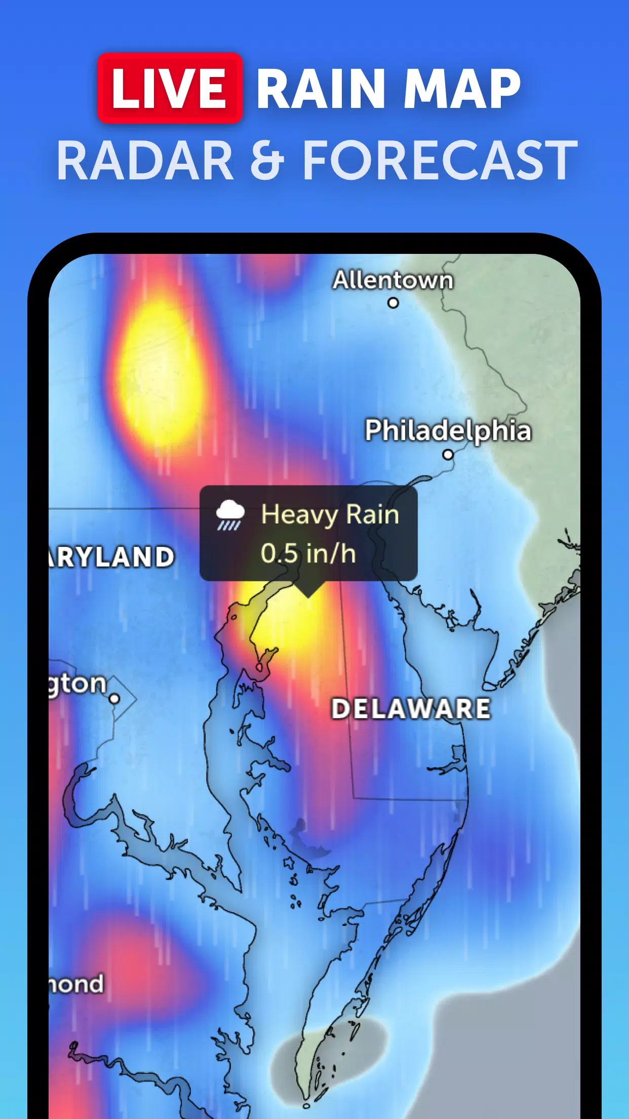
2. Rain Radar: Track approaching storms with a live weather radar map displaying real-time rain and snow data from ground-based Doppler radar.
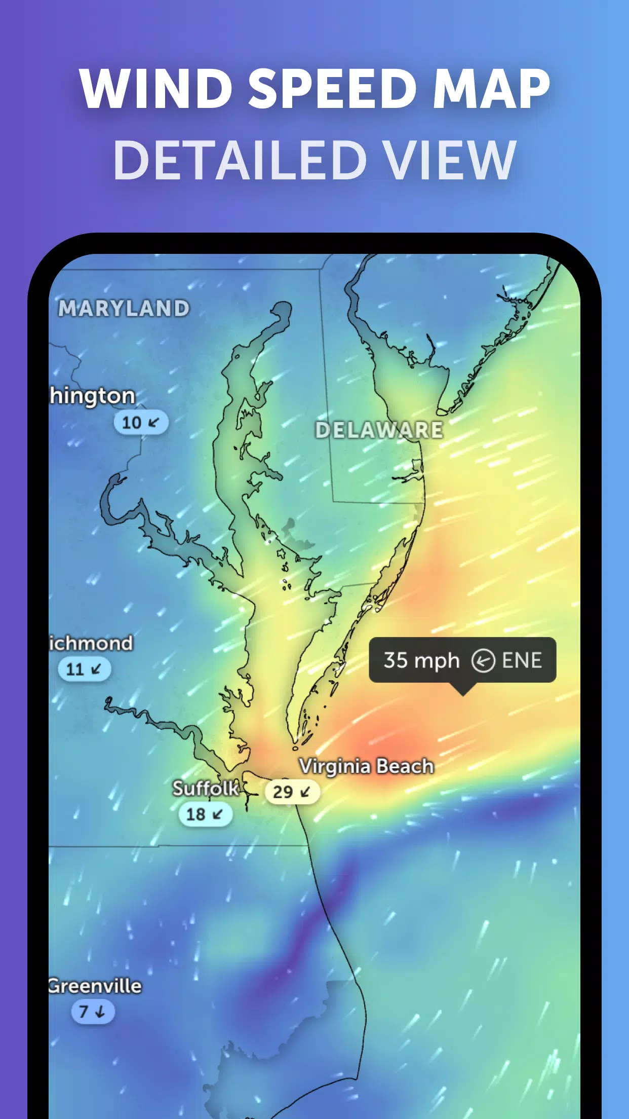
3. Weather Forecast Maps: Access stunning interactive global forecast maps showing precipitation, wind speed and gusts, temperature, "feels like" readings, relative humidity, dew point, and atmospheric pressure.
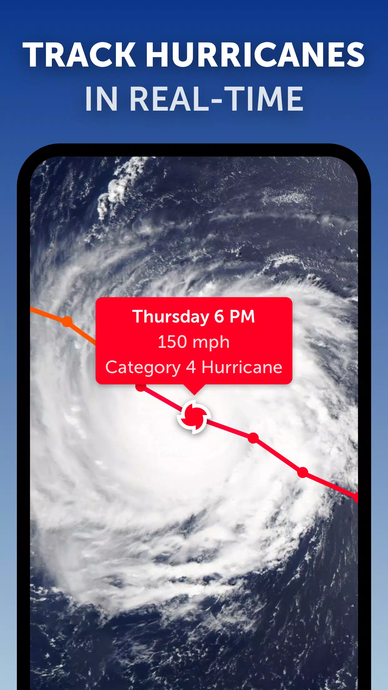
4. Hurricane Tracking: Stay updated on hurricane activity from formation to Category 5 with our advanced tropical tracking system using the latest data from NHC, JTWC, NRL, and IBTrACS.
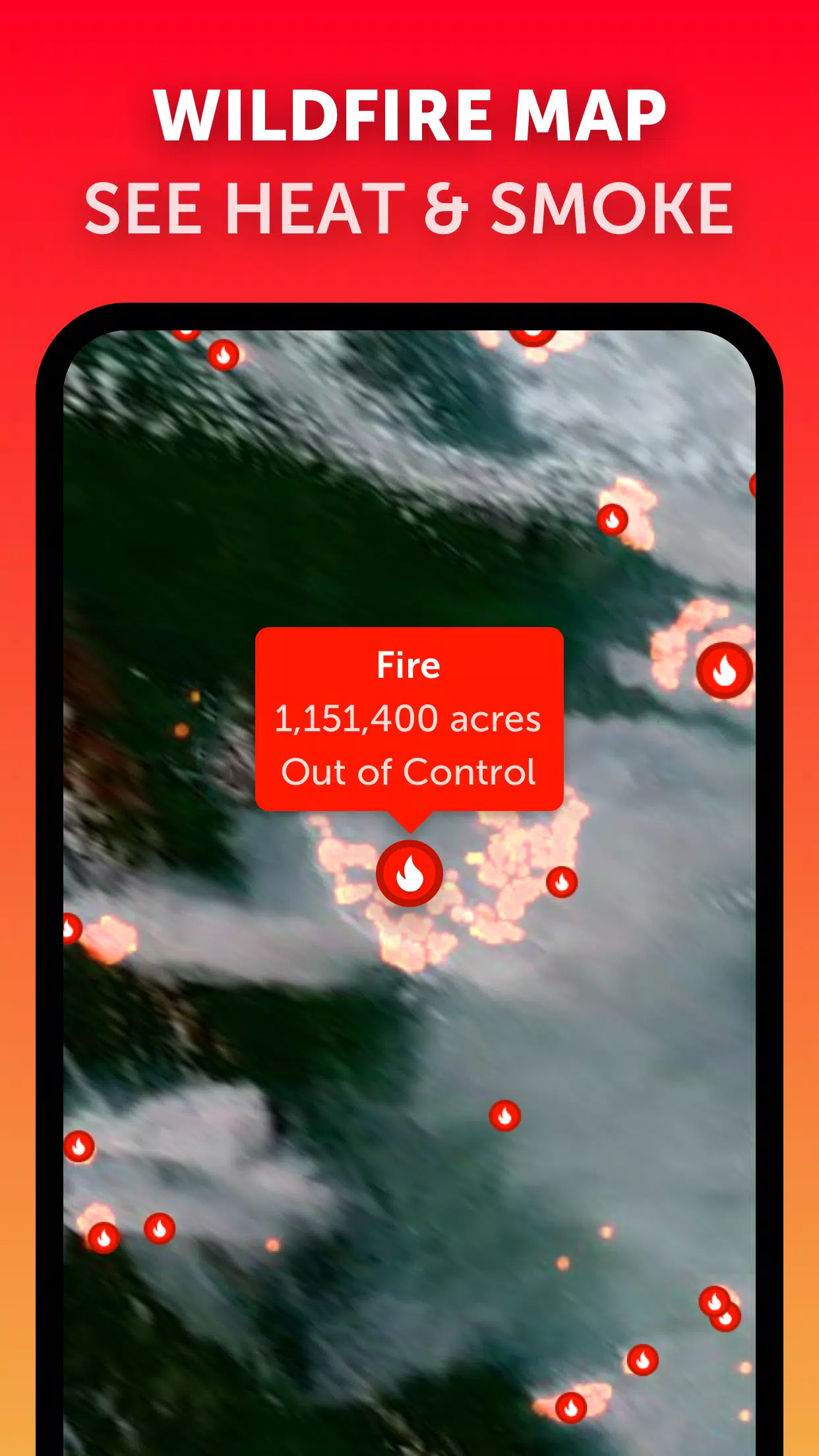
5. Wildfire Tracking: Monitor active wildfires and heat hotspots with daily updates from NASA FIRMS, showing areas of exceptionally high temperatures detected via satellite.
6. Customization: Personalize your experience by adjusting temperature units, wind measurement units, time zones, animation styles, and more in the comprehensive settings menu.
What's New in the Latest Version 3.1
Last updated on Sep 19, 2024
- Reduced visual clutter when multiple tropical systems are active.
- Separate alerts for Atlantic and Eastern Pacific storm systems.
- Enhanced map label readability.