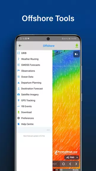
Features of PredictWind Offshore Weather:
⭐ Comprehensive Data: PredictWind Offshore Weather provides access to all the world's top-ranking forecast models, ensuring you have reliable and accurate weather data at your disposal.
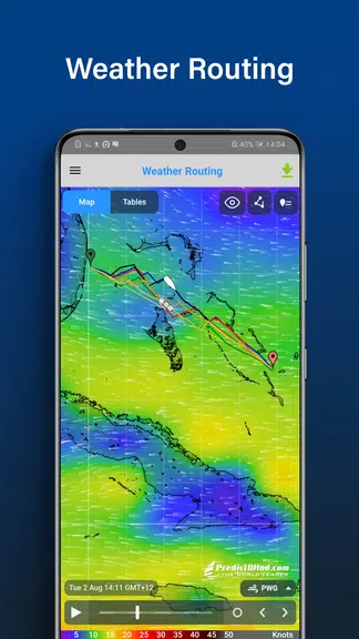
⭐ Powerful Marine Tools: Beyond forecasts, the app includes a suite of marine tools for weather routing, departure planning, and more, designed to enhance your safety at sea.
⭐ High-Resolution Maps and Graphs: Users can explore high-resolution forecast maps with animated streamlines, wind barbs, or arrows, and compare multiple parameters on detailed graphs.
FAQs:
⭐ Is the app compatible with satellite connections?
Yes, the app is designed to work seamlessly with most satellite connections, including devices like Iridium GO! and Globalstar.
⭐ Can I view GMDSS forecasts on the app?
Absolutely, users can access GMDSS forecasts in both text and map formats for comprehensive weather insights.
⭐ Does the app offer GPS tracking features?
Yes, you can enjoy a free customized GPS tracking page for your blog or website, plus view AIS data for vessels worldwide.
Conclusion:
With its extensive data, powerful marine tools, high-resolution maps and graphs, ocean data, and AIS tracking features, PredictWind Offshore Weather stands as the ultimate app for sailors and boaters seeking accurate weather forecasts and advanced navigation tools. Stay safe and informed at sea with this all-in-one offshore weather solution.